THE EXPERIENCE
Hiking route through the Natural Park of the Western Valleys.
La Senda de Camille is walking, going by foot from refuge to refuge: from Linza, in Ansó, to Selva de Oza and Gabardito in the valley of Hecho and Lízara, from Aragüés del Puerto, to Somport, closing the route through France. A week in the mountain, backpack on shoulder, along trails in forests and hills, through valleys and peaks, feeling part of the immensity of the mountains. And in the shelters, with a cold beer, share your experience with other mountaineers.
We provide you with everything you need to make your trip an unforgettable experience. Also the safety and comfort of an outing with a guide, to learn about the mountains and their inhabitants. www.lasendadecamille.com
BOOKING AND CONTACT
VAL D´ECHO ACTIVA
Ctra. de Oza, 2,
22720, Hecho (Huesca)
www.lasendadecamille.com
606 368 481
info@lasendadecamille.com
From Selva de Oza to Gabardito (through Acher)
We will enter the thick forest of Oza to approach the slopes of the Castle of Acher, the most emblematic mountain of the Echo Valley. We will also pass through one of the least known and most surprising corners of the area, Secús and Taxeras.
Time: 7:30 h.
Distance: 15,3 km
Positive difference in altitude: 1300 m
Negative difference in altitude: 1040 m
Somport to Arlet
We enter the French side, with its dense forest, sheep shepherd’s huts and its fantastic local cheese. The cirque of Aspe and the valley of Espelunguera are two of the most beautiful points of this stage, without underestimating the place where the refuge is located, the Ibón de Arlet, with stunning views of the Midi d’Ossau. Also, once you are at the refuge, in 20 minutes you can reach the border and, if the afternoon is clear, take a look at Aguas Tuertas, an impressive corner of the Western Valleys Natural Park.
Time: 6-7 hours.
Distance: 18.9 km
Elevation gain: 1150 m
Negative difference in altitude: 780 m
Linza to Oza Forest
In front of the Linza refuge we will take the path to reach the Caballo pass and continue towards Anzotiello, Mallo Gorreta and the Quimboas, among others, which look like an impassable wall, the descent towards Guarrinza will allow us to see prehistoric vestiges. And in Selva de Oza we will be able to enjoy a beer under the monumental beech of the canteen.
Time: 6 h.
Distance: 15,3 km
Positive difference in altitude: 800m
Negative difference in altitude: 1050m
Gabardito a Lizara
This would be the shortest stage if you do not climb the Bisaurín, because from one shelter to the other you can arrive in less than 4 hours. But the climb to the Bisaurín, which is one of the highest peaks in the area and a classic cross-country skiing in winter, although tough, it can be spectacular. Another option is to hike the Sierra de las Cutas instead of walking through the pastures of the passes of Dios te Salve, Plandániz and Foratón.
Time: 3-4 hours (6 hours if we climb the Bisaurín).
Distance: 9.6 km
Positive difference in altitude: 693 m
Negative difference in altitude: 536 m Almost 700 m more if we climb the Bisaurín.
Arlet to Lescun
We will walk almost parallel to the line dividing the two Pyrenean slopes. The passes of Saoubathou and Lo Palo have been crossed by man throughout history: to go to work or to escape from the wars, these passes sometimes took the lives of the walkers if the escape was made in winter, but they also witnessed the solidarity of the anonymous villagers on both sides, who risked their lives to help those who escaped. The descent towards the valley of Lescun plunges us into the quiet life of the Béarn villages. The sharp peaks of the Cirque de Lescun contrast with the intense green of the meadows, dotted with cottages and grazing cattle.
Time: 7 – 7:30 hours.
Distance: 19.5 km
Elevation gain: 520 m
Negative difference in altitude: 1640 m
Lizara to Somport
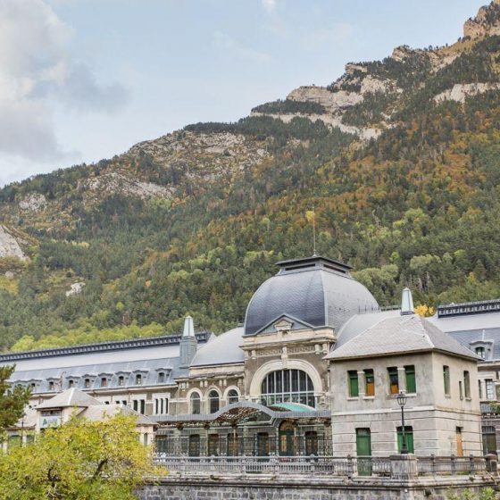
This is one of the most beautiful stages, as both the Sarrios Valley and the Ibón de Estanés are breathtaking. It is not too hard, but it is long. It starts with an ascent of about 2 hours, and then flat along the Paul de Bernera and the Sarrios Valley, down to the lake and crossing the Bosque de las Hayas towards the Somport pass. At the old border is the Aysa Hostel.
Time: 6-7 hours.
Distance: 17,4 km
Elevation gain: 1070 m
Negative difference in altitude: 980 m
Lescun to Linza
The stage starts on a paved road, but the impressive view of the Cirque de Lescun, with the rocky massifs of Les Billaires, Mesa de los Tres Reyes and Petrachema will delight us along the way. On the plain of Ansabere we can take advantage of the last opportunity to buy French cheese. From there, the ascent to the Needles will require more effort. We enter again in Aragón and descend towards Linza among centenary beech trees.
Time: 7 h.
Distance: 16.6 km
Positive difference in altitude: 1.290 m
Negative difference in altitude: 790 m


